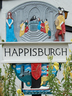
Happisburgh as a village...
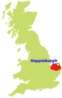
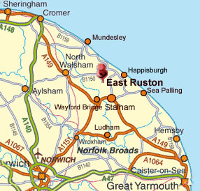
Happisburgh is a English coastal village, just off the B1159 coast road from Ingham to Becton.
Happisburgh became a place of national archaeological importance back in 2010, when flint tools over 800,000 years old were found. This is the oldest evidence of human activity anywhere in the UK.
The area of Happisburgh measures 10.78 km2.
The Population, (cording to the Happisburgh parish council census of 2001,) was 1,372.
The Density of Happisburgh 127 km2 or 330 per square meter, however this is falling due to rate of cliff erosion!!
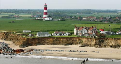
Happisburgh used to have a coast road right along the coast top, but because of erosion there no long is a coast road...
Local features -
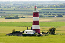
Light House -
The red-and-white striped light house is the only independently operated lighthouse in Great Britain. It is also the oldest working lighthouse in East Anglia and was built in 1790. It is open to the public on occasional Sundays during the summer.
St. Mary's Church-
In 1086, the Normans built a church on the site of the current one. It was demolished and rebuilt in the 15th century. The tower of St Mary's church is an important landmark to mariners warning of the position of the treacherous nearby sandbanks. The church's octagonal font, in the 15th century had figures of lions and satyrs carved in.
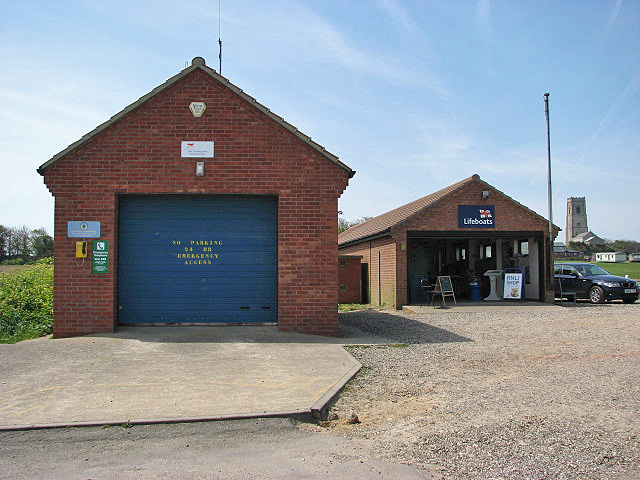
Lifeboat station-
A small boathouse was built in a similar site of the one now station now, in 1987 the old boathouse was replaced by the new station that stands at the moment, with a more modern building and better facilities for crews.
This was further extended in 1998 with a new D class lifeboat.
In December 2002 the lifeboat launching ramp was washed away due to massive erosion.
A temporary station was opened within three months at Old Cart Gap.
The original station is now used for training and souvenir sales.
The station has been honored with an Royal National Lifeboat Institution (RNLI) Silver Medal!!!
Happisburgh became a place of national archaeological importance back in 2010, when flint tools over 800,000 years old were found. This is the oldest evidence of human activity anywhere in the UK.
The area of Happisburgh measures 10.78 km2.
The Population, (cording to the Happisburgh parish council census of 2001,) was 1,372.
The Density of Happisburgh 127 km2 or 330 per square meter, however this is falling due to rate of cliff erosion!!
Happisburgh used to have a coast road right along the coast top, but because of erosion there no long is a coast road...
Local features -
Light House -
The red-and-white striped light house is the only independently operated lighthouse in Great Britain. It is also the oldest working lighthouse in East Anglia and was built in 1790. It is open to the public on occasional Sundays during the summer.
St. Mary's Church-
In 1086, the Normans built a church on the site of the current one. It was demolished and rebuilt in the 15th century. The tower of St Mary's church is an important landmark to mariners warning of the position of the treacherous nearby sandbanks. The church's octagonal font, in the 15th century had figures of lions and satyrs carved in.
Lifeboat station-
A small boathouse was built in a similar site of the one now station now, in 1987 the old boathouse was replaced by the new station that stands at the moment, with a more modern building and better facilities for crews.
This was further extended in 1998 with a new D class lifeboat.
In December 2002 the lifeboat launching ramp was washed away due to massive erosion.
A temporary station was opened within three months at Old Cart Gap.
The original station is now used for training and souvenir sales.
The station has been honored with an Royal National Lifeboat Institution (RNLI) Silver Medal!!!
FACTS
- In 1958 40 feet of the cliffs fell.
- Happisburgh is a barrier for the broads.
- In 1970 Sea defenses that were there wore away.
- In 2003 there was a public meeting held to discuss the matter of, due to new government policy there was now limited funding.
- Loss of loved cliff top cafe.
- Pub loosing customers.
- Loss of habitat for Sand Martins.
Below there is Google maps providing a map showing where Happisburgh followed by a photo gallery
( please open images full size by clicking on them to see caption and full photo thanks...)